Positioning an RTK Base station in Europe
1. Convert a log file into a RINEX file
- Go to the LOGS tab of your RTK base and click the pencil (
edit) on a complete 24-hour .zip file.
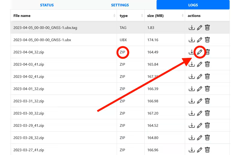
- A window opens offering to convert the log file into a RINEX file.
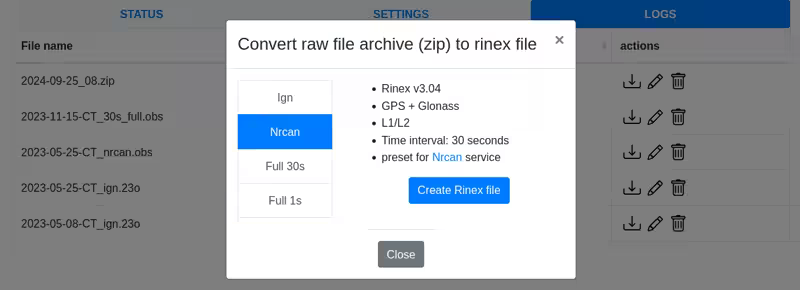
- If you are outside France: Use a log file older than 15 days, then choose the NRCAN preset, which is compatible with NRCAN's online services for precise positioning calculation. Click Create Rinex File.
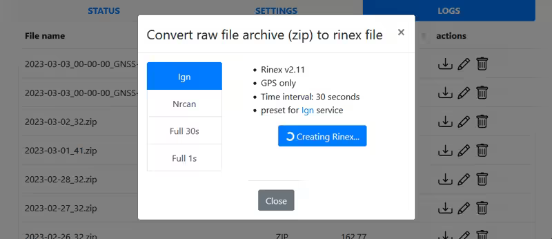
- Wait while the RINEX file is created; this may take several minutes.
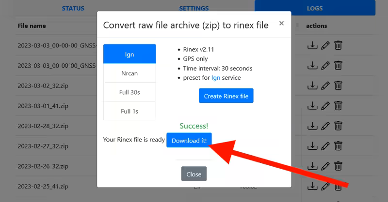
- Download the generated file. Once the window is closed (
close), the RINEX file is also available in the logs list with a name like YYYY-MM-DD-your_mountpoint_name_nrcan.obs and a size of about 4 MB.
2. Post-processing
Make sure to use a RINEX file older than 15 days to obtain precise positioning!
This step corrects the raw data from your RTK base using the PPP method provided by NRCAN.
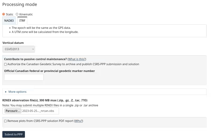
- Go to the NRCAN website
- Start a session by entering your information
- Choose static processing mode and ITRF
- Upload the RINEX observation file generated previously
- Click Submit to PPP
Download links are sent to your email after a few minutes:
- Click full_output.zip to download it
- Click summary to display it
The two documents (summary and full_output.zip) + the previously generated RINEX file will be required when declaring your station, so make sure to keep all of this information.
3. Interpreting the report
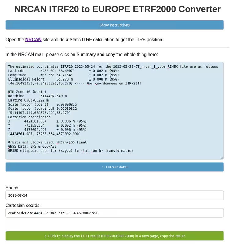
- Copy the summary
Example of an NRCAN summary file:
The estimated coordinates ITRF20 2023-05-24 for the 2023-05-25-CT_nrcan_1_.obs RINEX file are as follows:
Latitude	N46° 09' 53.4007"	± 0.002 m (95%)
Longitude	W0° 56' 54.7154"	± 0.002 m (95%)
Ellipsoidal Height	65.270 m	± 0.008 m (95%)
[46.16483353,-0.94853206,65.270] <---- Your coordinates in ITRF20!!

UTM Zone 30 (North)
Northing	5114407.540 m
Easting	658376.222 m
Scale factor (point)	0.99990835
Scale factor (combined)	0.99989812
[5114407.540,658376.222,65.270]

Cartesian coordinates
X	4424561.087	± 0.006 m (95%)
Y	-73255.334	± 0.002 m (95%)
Z	4578002.990	± 0.006 m (95%)
[4424561.087,-73255.334,4578002.990]

Orbits and Clocks Used: NRCan/IGS Final
GNSS Data: GPS & GLONASS
GRS80 ellipsoid used for (x,y,z) to (lat,lon,h) transformation- Go to ITRF20 to ETRF2000 conversion, paste the summary, and click 1. Extract data
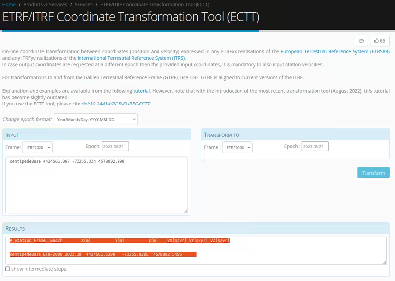
- Click 2. Click to display the ECTT result... to convert the ITRF2020 coordinates into ETRF2000. A new tab will open with the converter from the EUREF Permanent GNSS Network. Copy the entire RESULTS section.
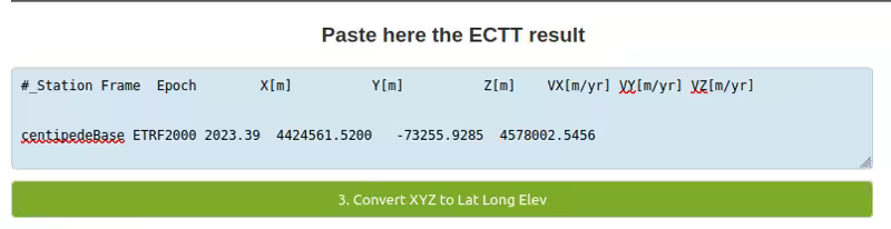
- Return to the previous page and paste the values, then click 3. Convert XYZ to Lat Long Elev
- The final coordinates of your GNSS base are now displayed. Click 4. Export Form Data .txt ... to download the conversion report so you can send it when declaring your station on the Centipede-RTK network.
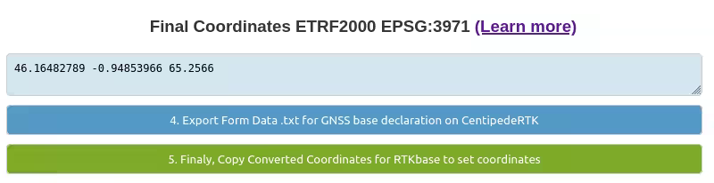
- Click 5. Finally, Copy Converted Coordinates for... to copy these values and insert them into the coordinate parameters of your GNSS base.
Your geographic coordinates are now expressed in a global system for geographic Europe that takes into account the movement of the Eurasian tectonic plate.
Each country often also has its own local coordinate system, such as RGF93 in France, to account for local movements. The differences are minor for RTK positioning (< 1 cm). If you need your coordinates to match the coordinate system used in your country, please let us know your requirements on the forum.
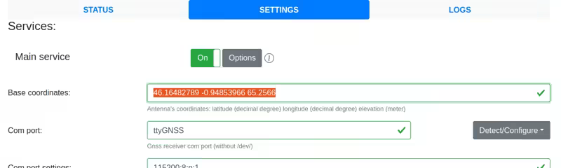
- Now proceed to the final step: Configuring the positioning of your RTK Base